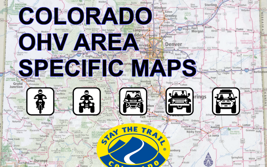
Below are maps for specific OHV areas:
NOTE: CONDITIONS AND ROUTES ARE SUBJECT TO CHANGE. ALWAYS REFER TO THE MVUM (MOTOR VEHICLE USE MAP) OR CONTACT THE APPROPRIATE LAND MANAGEMENT AGENCY FOR THE MOST CURRENT AND UP TO DATE INFORMATION.
An interactive state wide OHV map can be found here: STATE WIDE MAP
Additional riding areas and tracks can be found here: ADDITIONAL RIDING AREAS
Make sure you review what locations allow OHV’s on town or county roads: OHV’S ON STREETS AND ROADS
(some maps are crude but give you an idea of the location and or trail system)
Download the COTREX app for a comprehensive guide to OHV routes in Colorado with corresponding activities/vehicles allowed including seasonal dates.
MAPS:
Arkansas Hills (Salida)
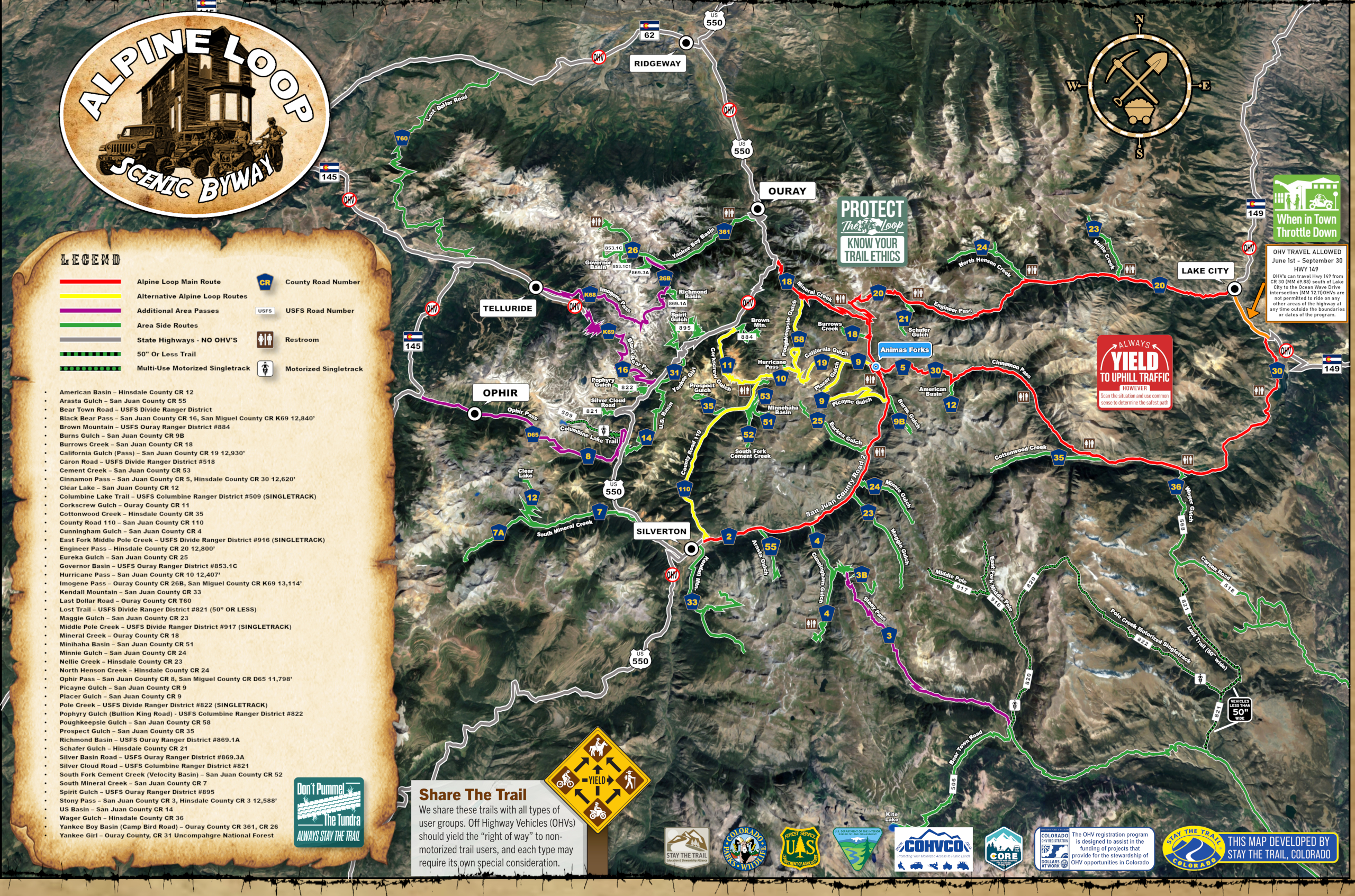
Alpine Loop Map (Lake City, Ouray, Silverton, Telluride)
Alpine Loop Map Overview (Lake City, Ouray, Silverton, Telluride)
- Animas Forks (Silverton)
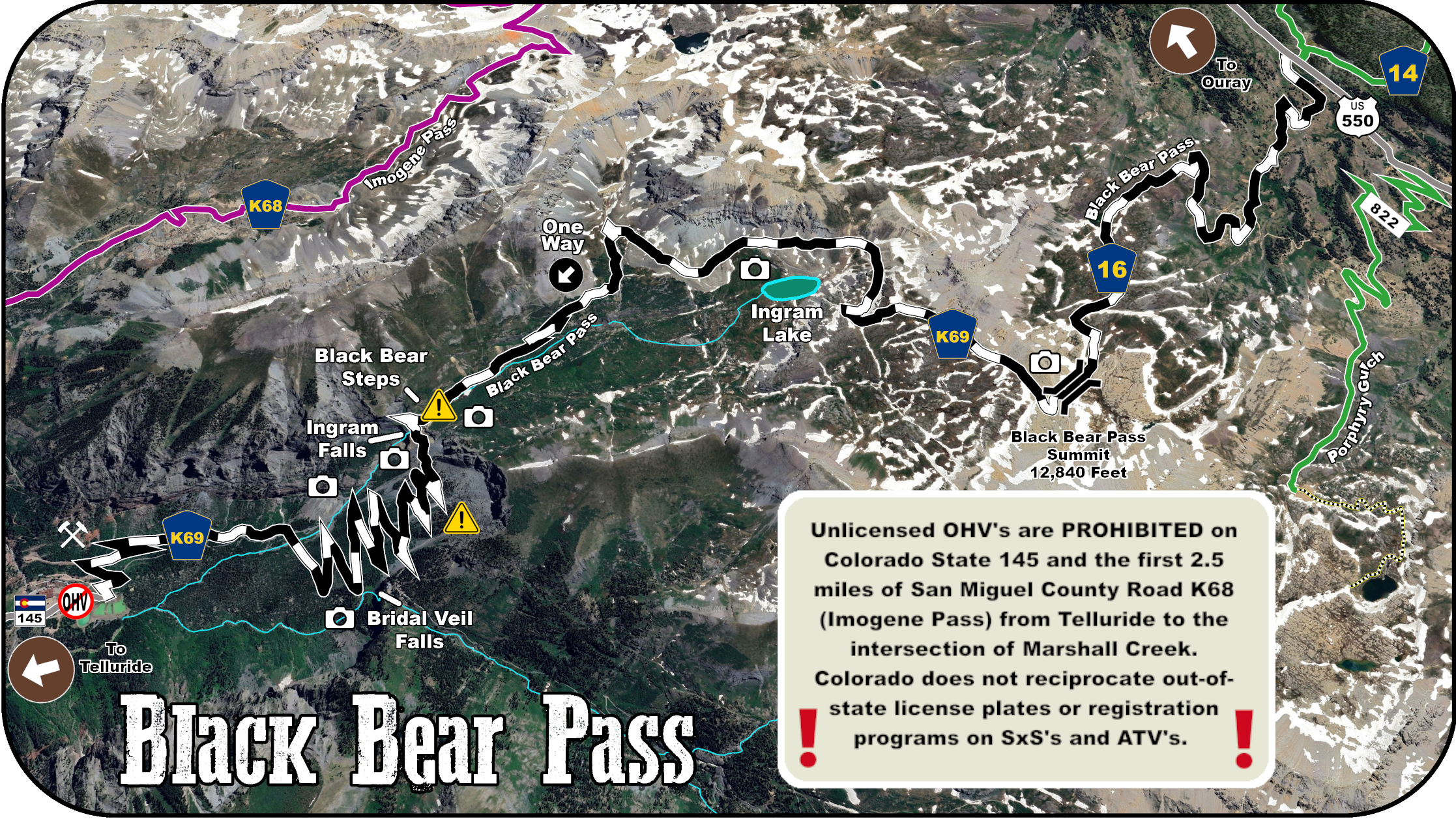
- Black Bear Pass (Ouray, Telluride)
- Bullion King Lake, Porphry Gulch (Ouray, Silverton)
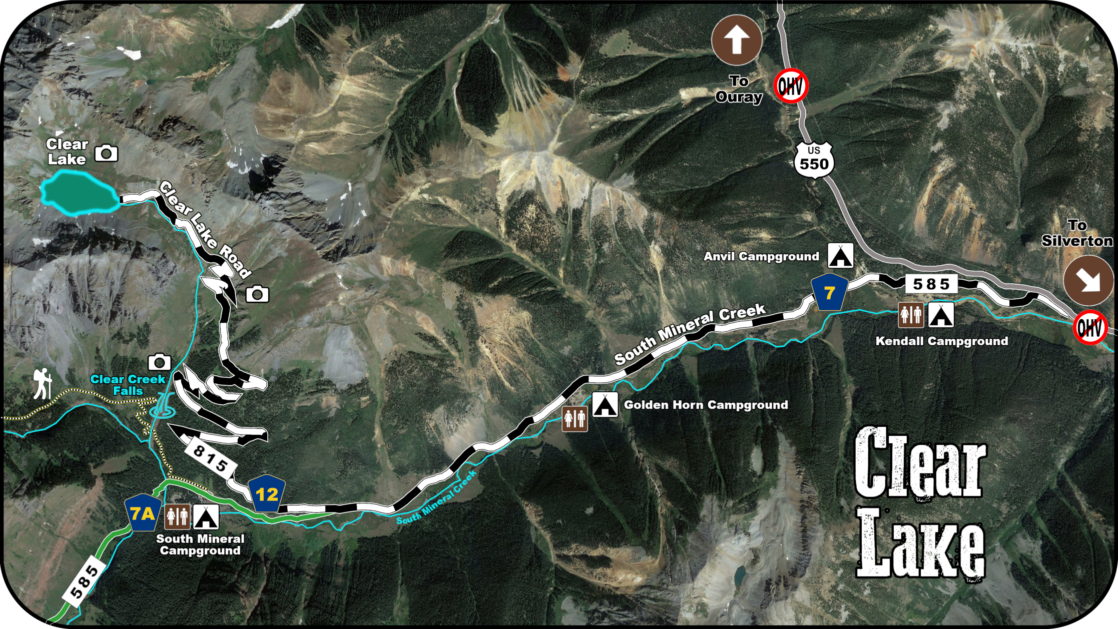
- Clear Lake (Silverton, Ouray)
- Engineer and Cinnamon Passes (Lake City, Silverton, Ouray)
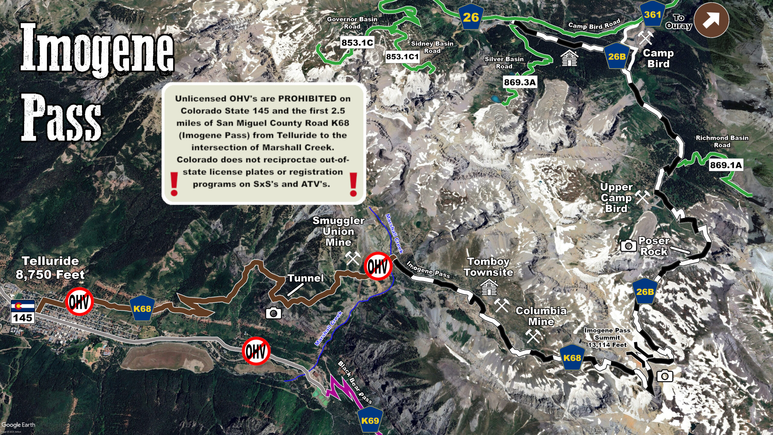
- Imogene Pass (Telluride, Ouray)
- Lake Emma, Eureka Gulch (Silverton)
- Mineral Creek, California Gulch, Corkscrew Gulch (Ouray)
- Placer Gulch, Picayne Gulch (Silverton)
- Poughkeepsie Gulch (Ouray, Silverton)
- Red Mountain Mining District (Ouray, Silverton)
- Stony Pass, Kite Lake (Silverton)
Bangs Canyon Area and Third Flats Map (Grand Junction, Mack, Loma)
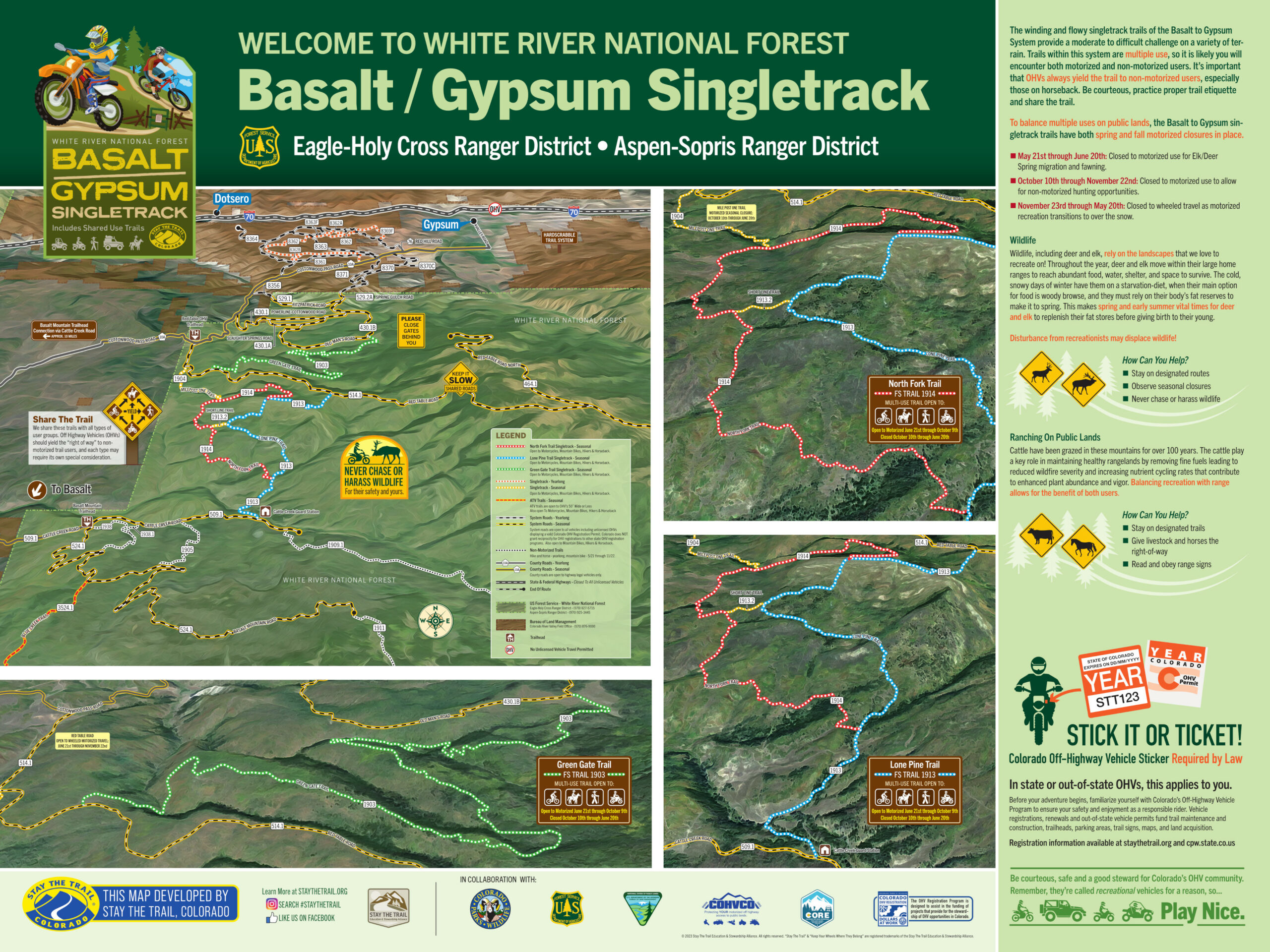
Basalt to Gypsum (Basalt, Gypusm)
Bocco Mountain Map (Wolcott)
Booger Red (Canon City)
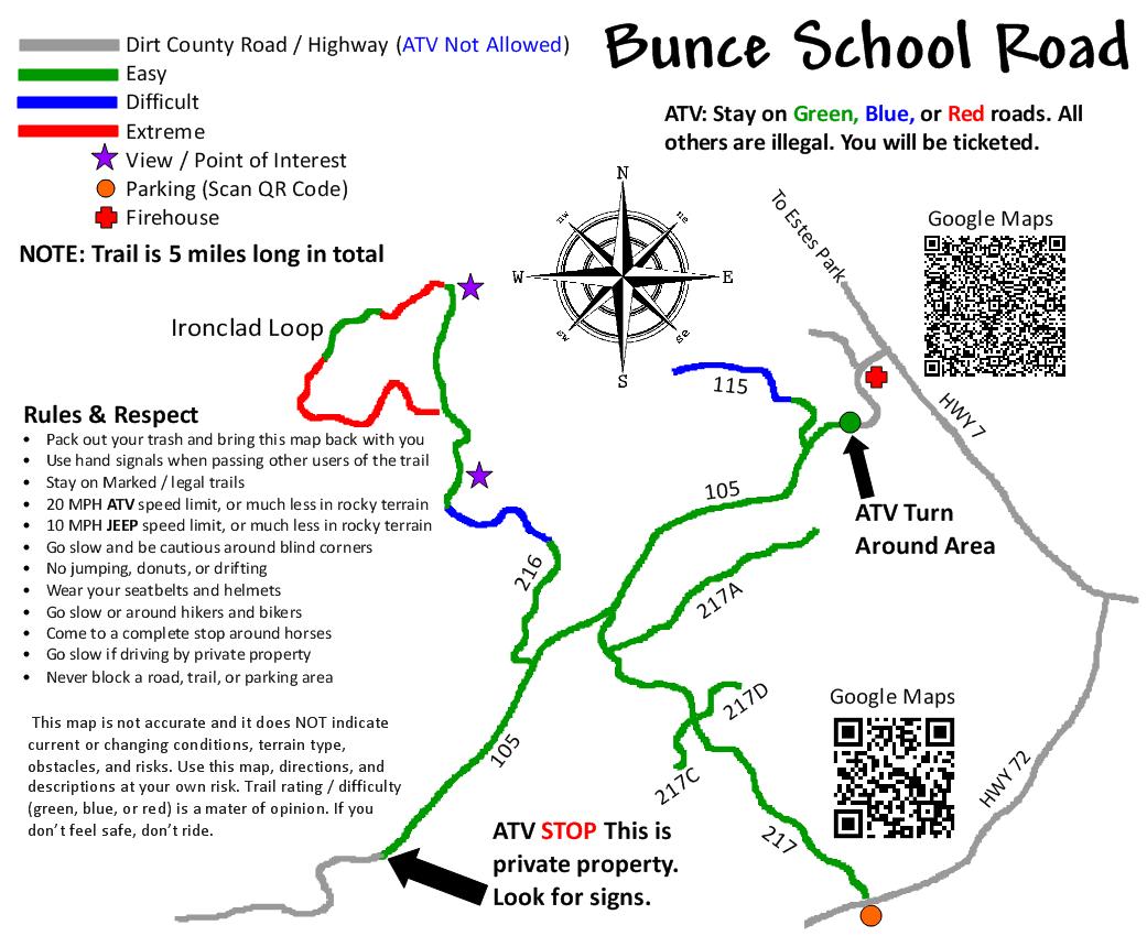
Bunce School Road Map (Allenspark, Ward)
Cache Creek Placer Area (Buena Vista, Leadville)
Captain Jack’s (Colorado Springs)
Cedar Mountain Map (Craig)
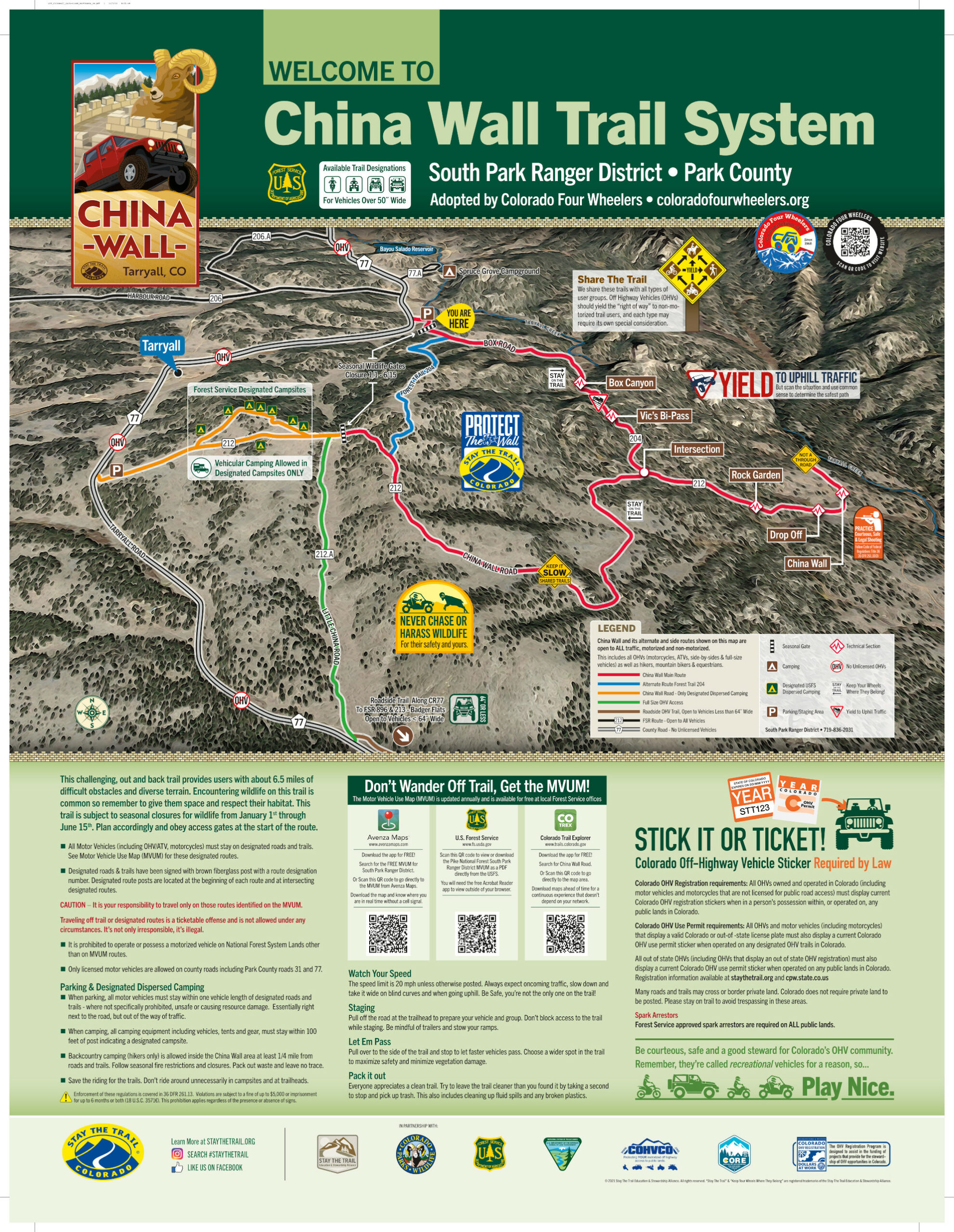
China wall (Tarryall, Florissant, Lake George)
Danner Pass (Fort Collins, Red Feather Lakes)
Deer Haven (Canon City, Guffey)
Dinosaur Flats (Canon City)
Fourmile Map Overview North and South (Buena Vista)
Fourmile South- Carnage Canyon, Yansing Gulch, Dud-Bob, Triad Ridge (Buena Vista)
Gateway Tenderfoot Mesa Map (Dolores, Gateway, Blue Mesa)
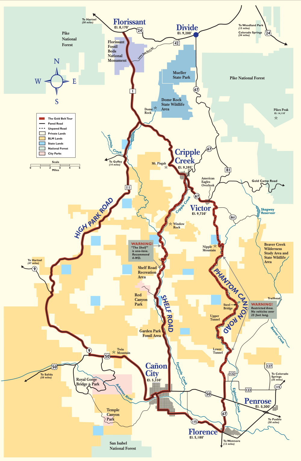
Gold Belt Scenic Byway (Florence, Victor, Cripple Creek, Canon City)
Georgia Pass (Breckenridge)
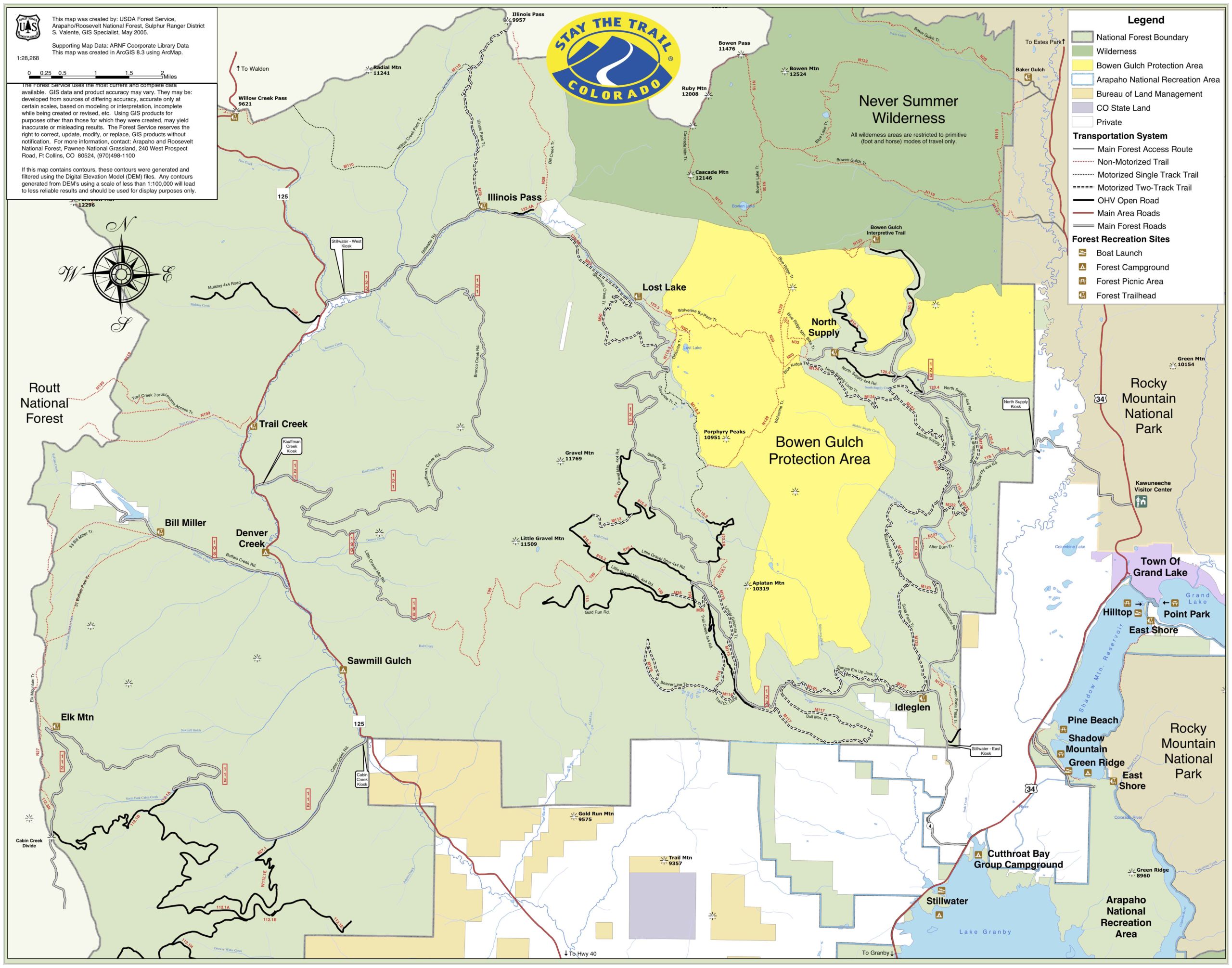
Grand Lake Area Map (Grand Lake)
Grand Mesa Map (Grand Junction, Powderhorn)
Gunnison Forks Map (Hotchkiss, Delta, Montrose, Gunnison)
Gunnison Gorge and Peach Valley Map (Hotchkiss, Delta, Montrose, Gunnison)
Gypsum Hills ERMA (Dotsero, Eagle, Gypsum)
Indiana Creek Road (Breckenridge)
Hardscrabble LARGE FILE SIZE (Eagle)
Hartman Rocks Map (Gunnsion)
Hubbard Mesa OHV area (Rifle)
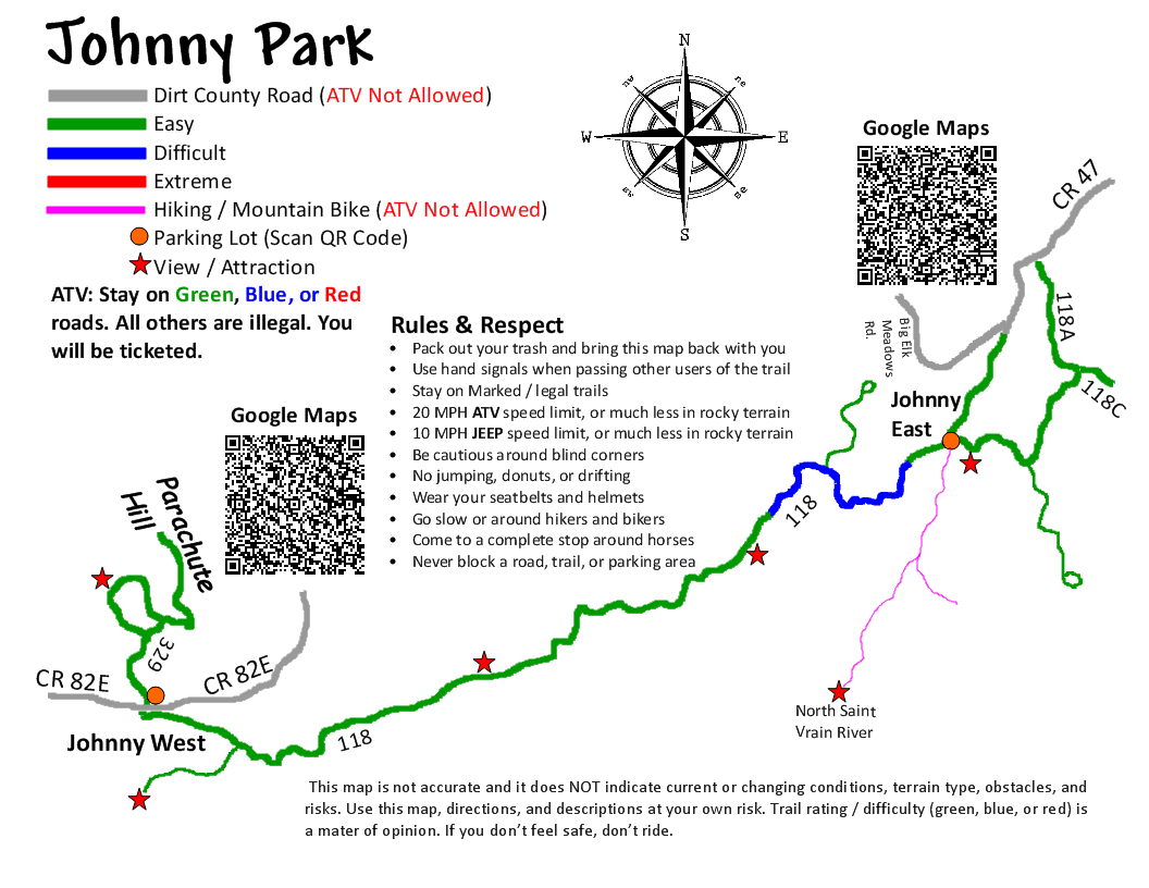
Johnny Park Road Map (Allenspark, Estes Park, Lyons)
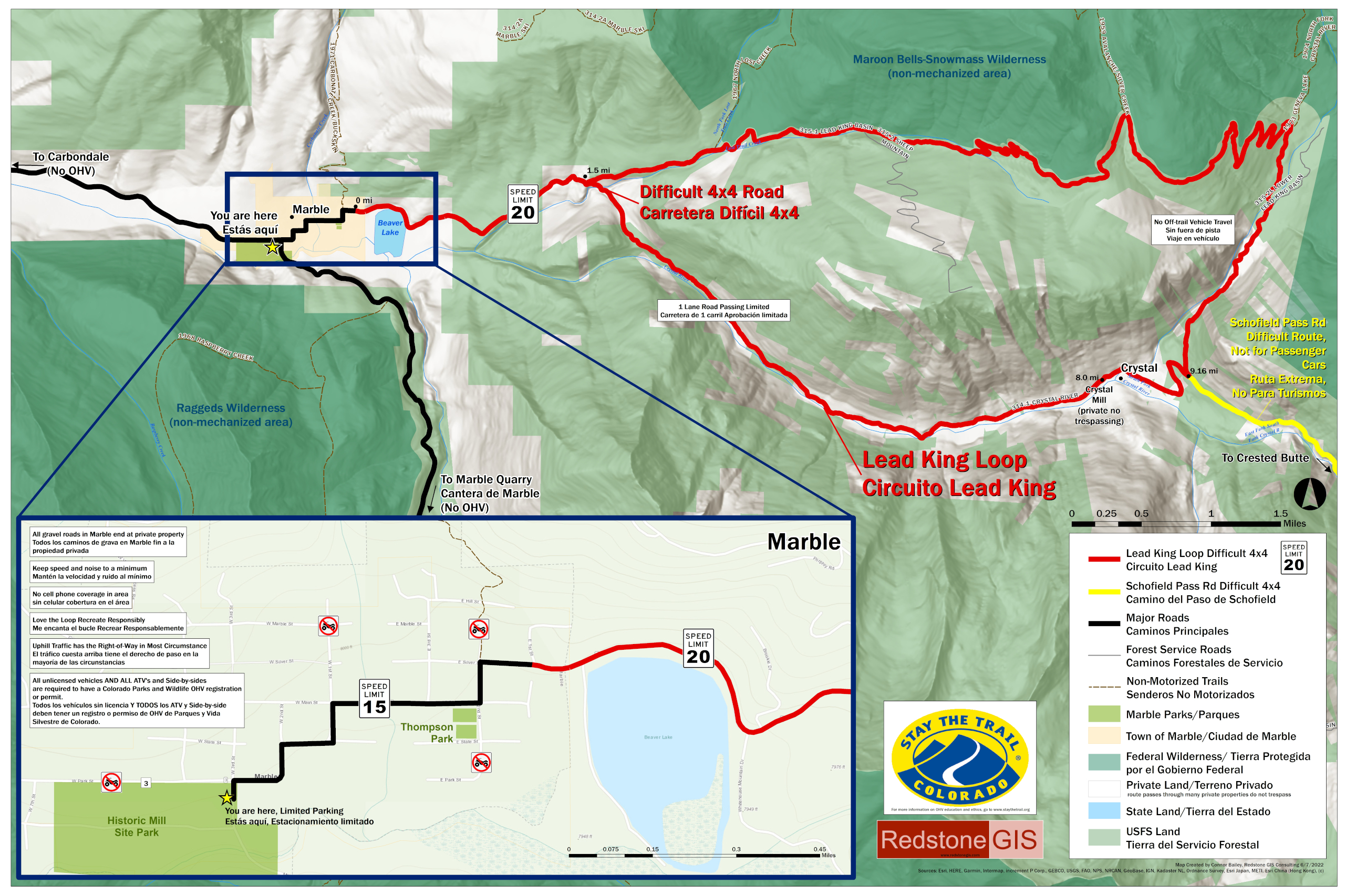
Lead King Loop (Marble, Crystal)
Marshall Pass to Poncha Creek Loop Map (Salida, Sargents)
McCallister Gulch (Red Cliff, Leadville)
Middle Fork Road, Swan River (Breckenridge, Montezuma)
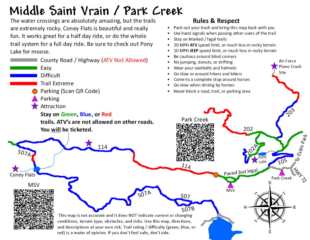
Middle Saint Vrain Map (Boulder, Allenspark)
Miners Loop Map (St. Elmo, Tincup, Taylor Park, Pitkin)
Monte Vista Area Map (Monte Vista, Del Norte, South Fork, Center)
Mt. Antero (St. Elmo, Tincup)
North Delta OHV open area (Delta)
North Divide & 717 (Divide)
North Fork Swan Road (Breckenridge, Montezuma)
North Sand Hills Recreation Area (Walden)
Oil Well Flats (Canon City, Cripple Creek)
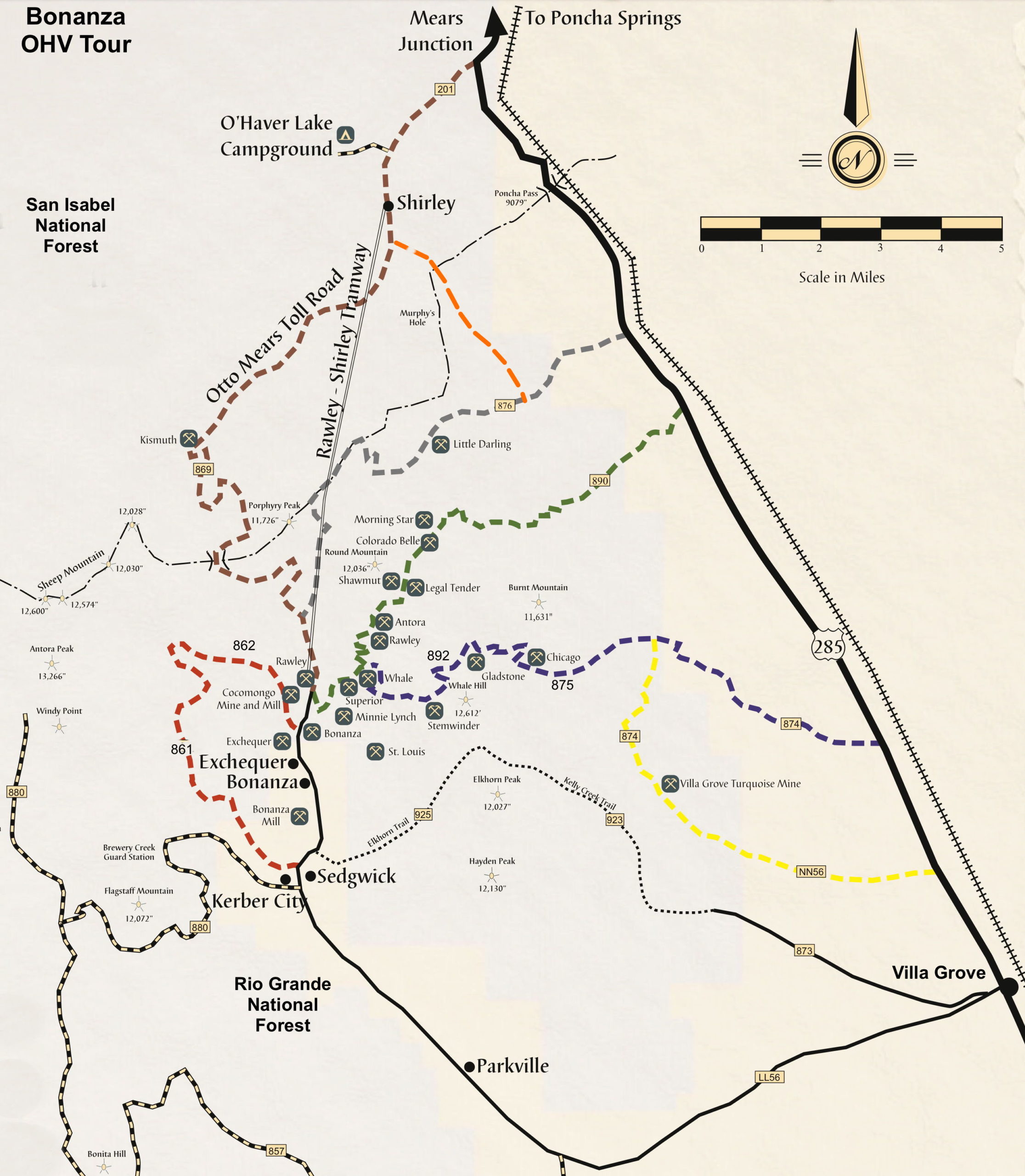
Otto Mears Toll Road Map (Salida, Bonanza, Saguache, Villa Grove)
Pennsylvania Creek Road (Breckenridge)
Penrose Commons (Penrose)
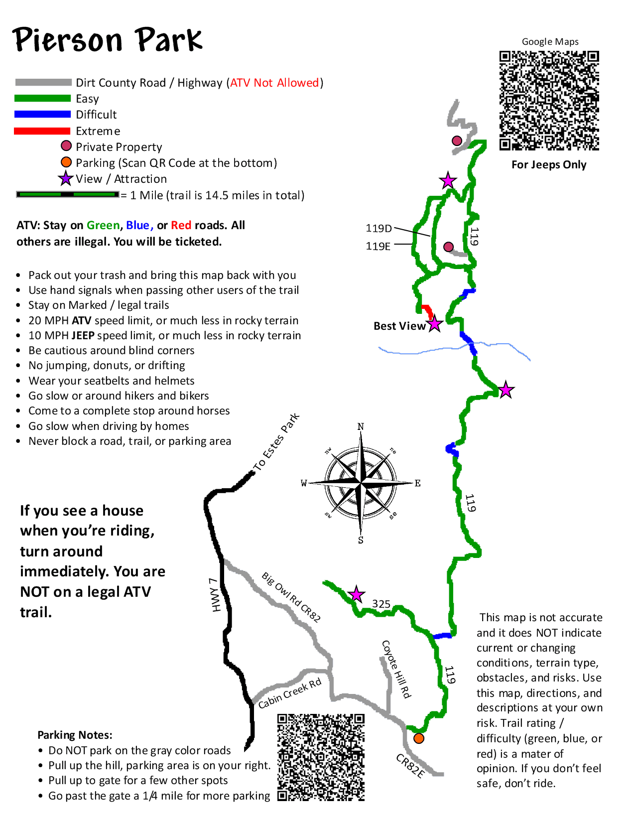
Pierson Park (Estes Park)
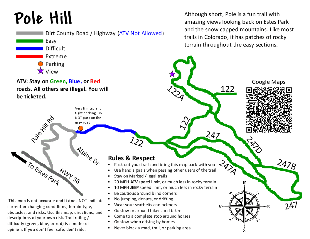
Poll Hill (Estes Park)
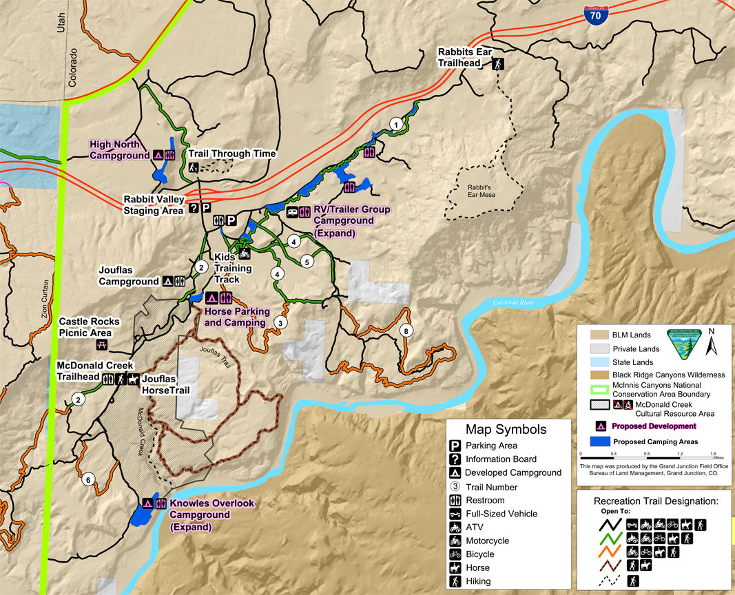
Rabbit Valley Map (Grand Junction, Mack, Loma)
Rainbow Falls Map (Woodland Park, Deckers)
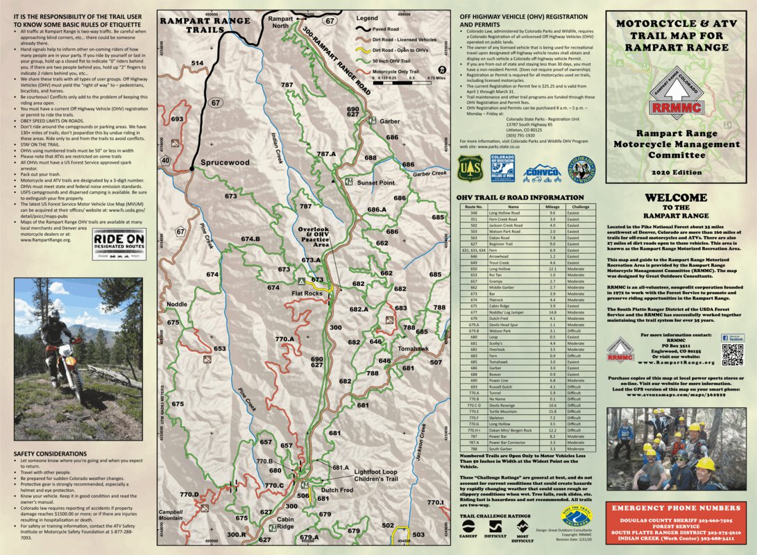
Rampart Range Area Map (Sedalia, Woodland Park, Deckers, Castle Rock)
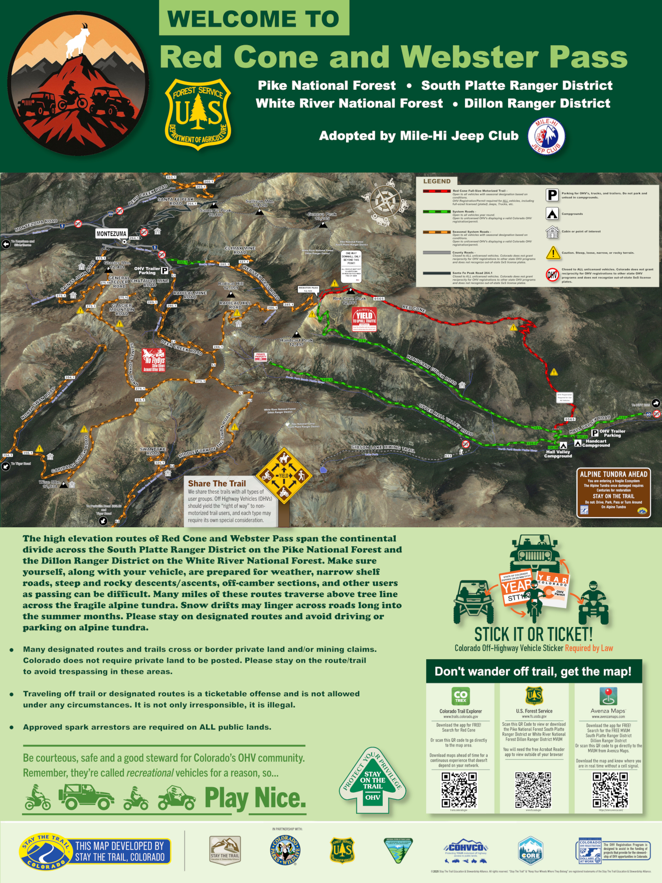
Red Cone and Webster Pass (Grant, Montezuma)
Roan Plateau (Rifle, Parachute)
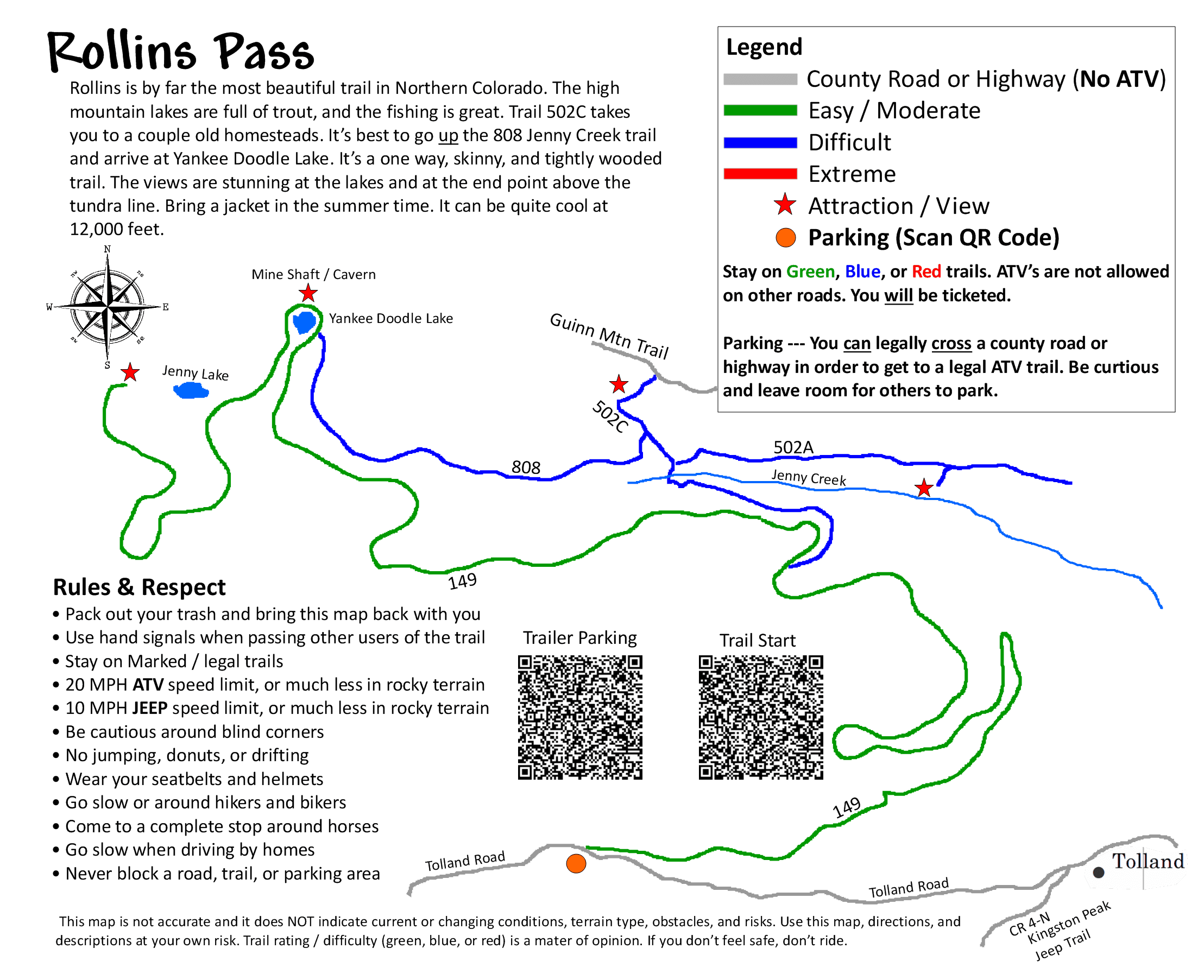
Rollins Pass East (Tolland)
Sand Gulch CG (Canon City, Cripple Creek)
Section 13 (Canon City)
Seep Springs (Canon City)
Shelf Road Recreation Area (Canon City, Cripple Creek)
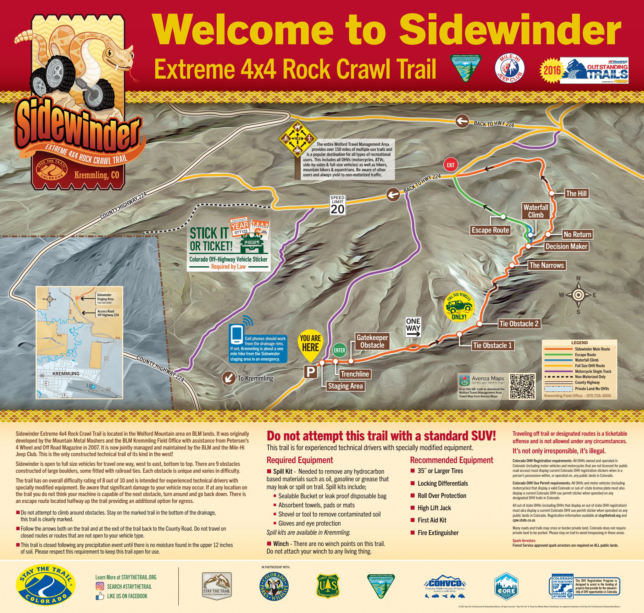
Sidewinder (Kremmling)
Silt Mesa (Silt)
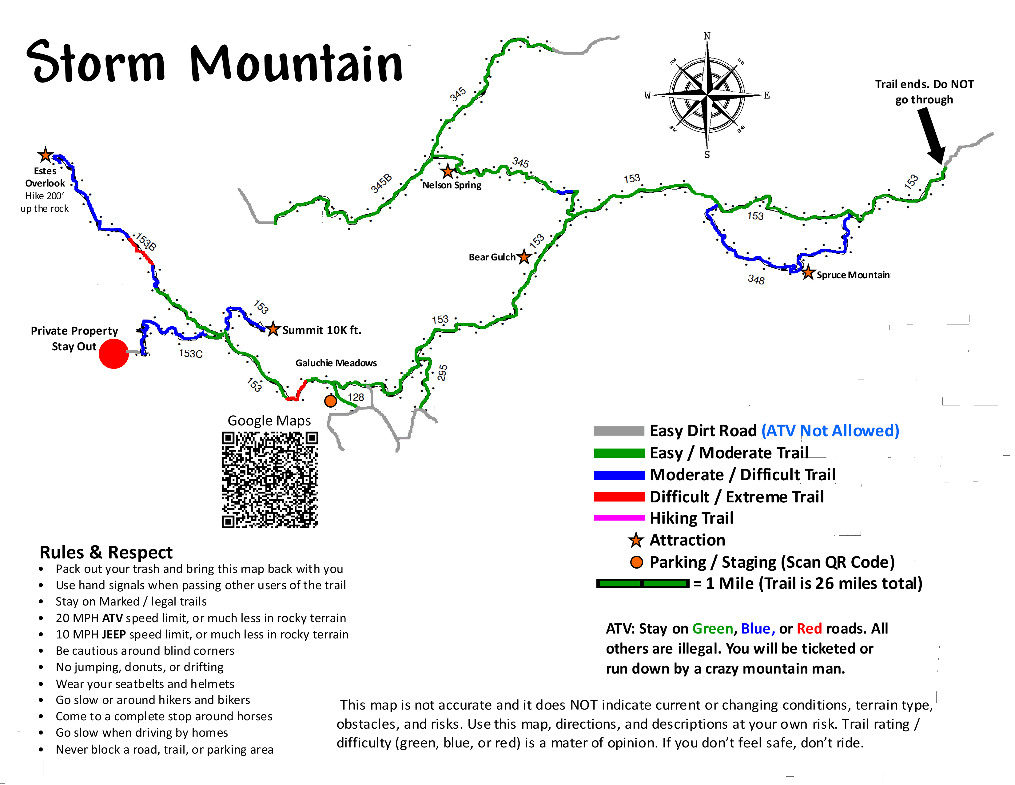
Storm Mountain (Estes Park)
South Canon (Canon City)
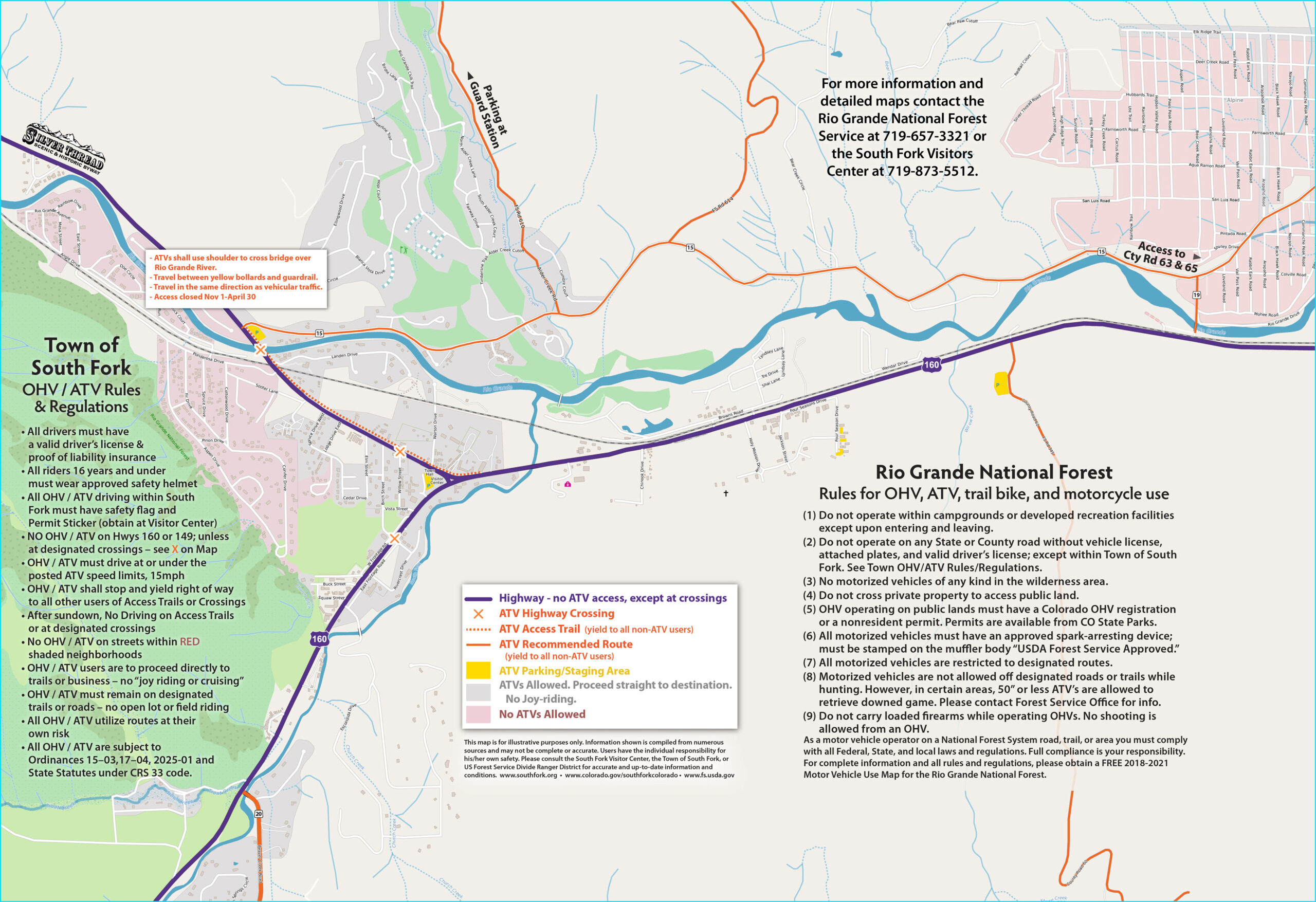
South Fork Town OHV Map (South Fork)
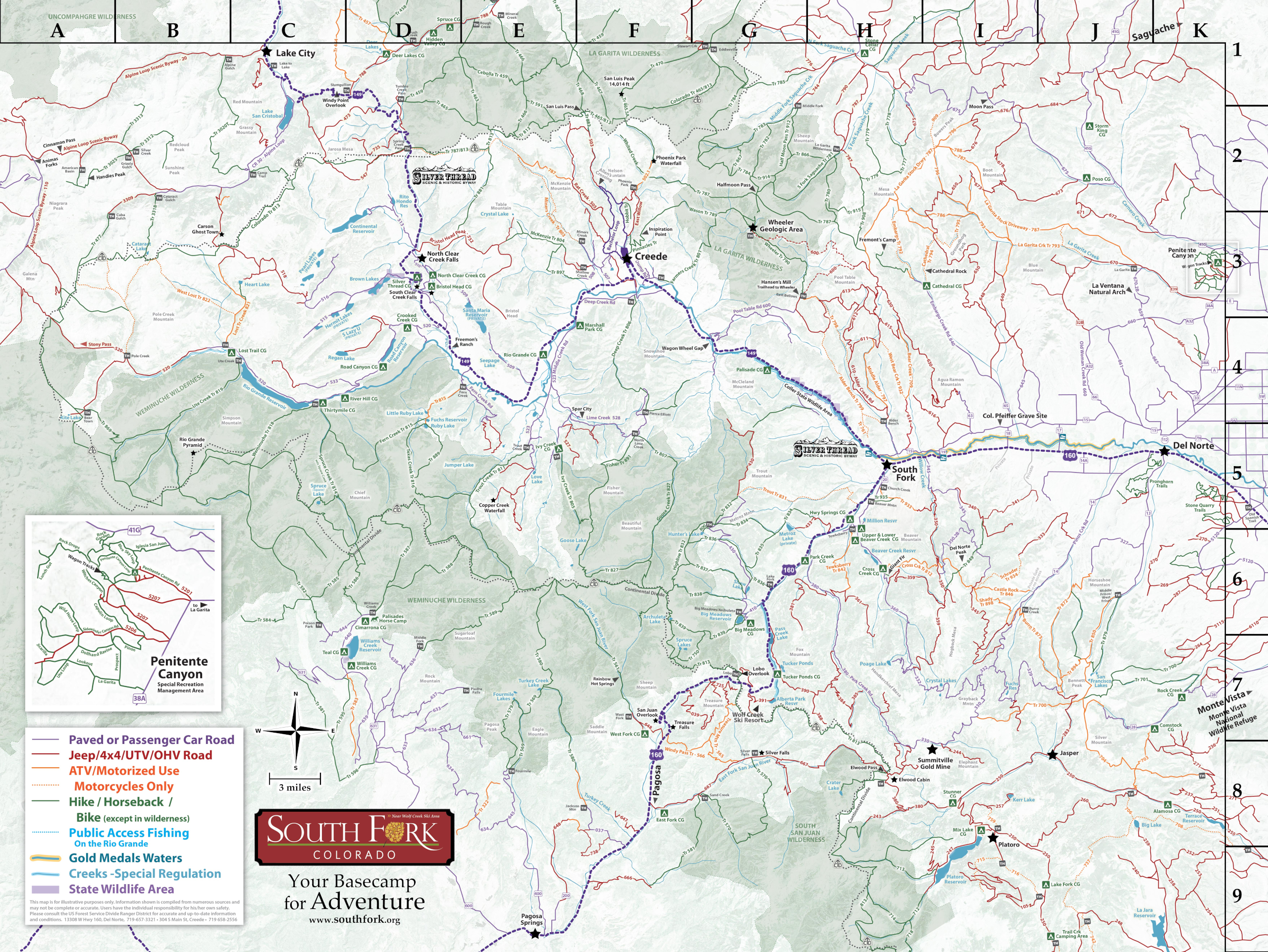
South Fork Area Trails (South Fork, Creede)
Saints John Road (Montezuma)
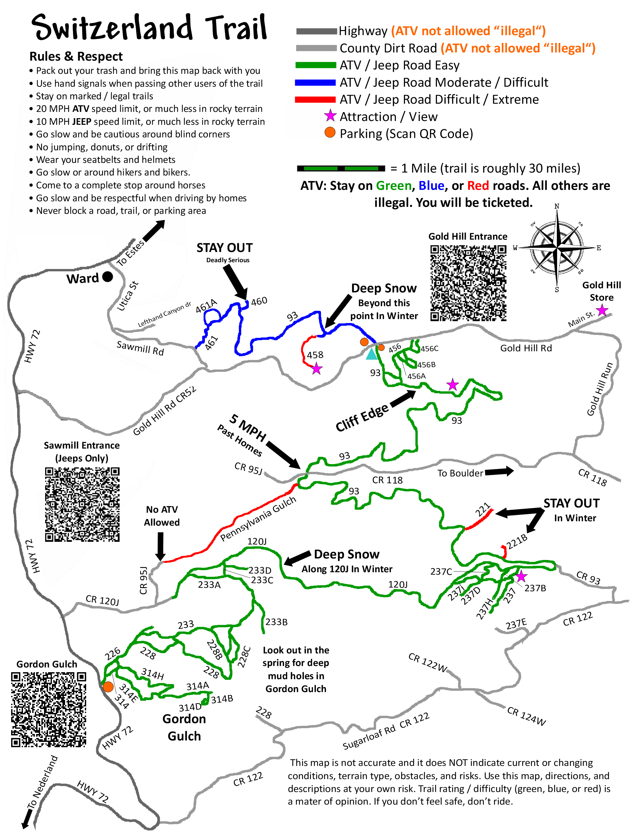
Switzerland Trail (Nederland, Ward)
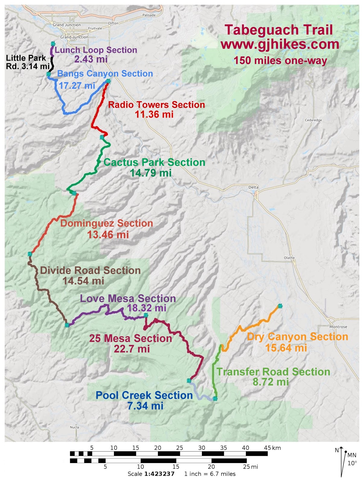
Tabeguache Trail (Grand Junction, Montrose)
Tenderfoot Area Map (Silverthorne)
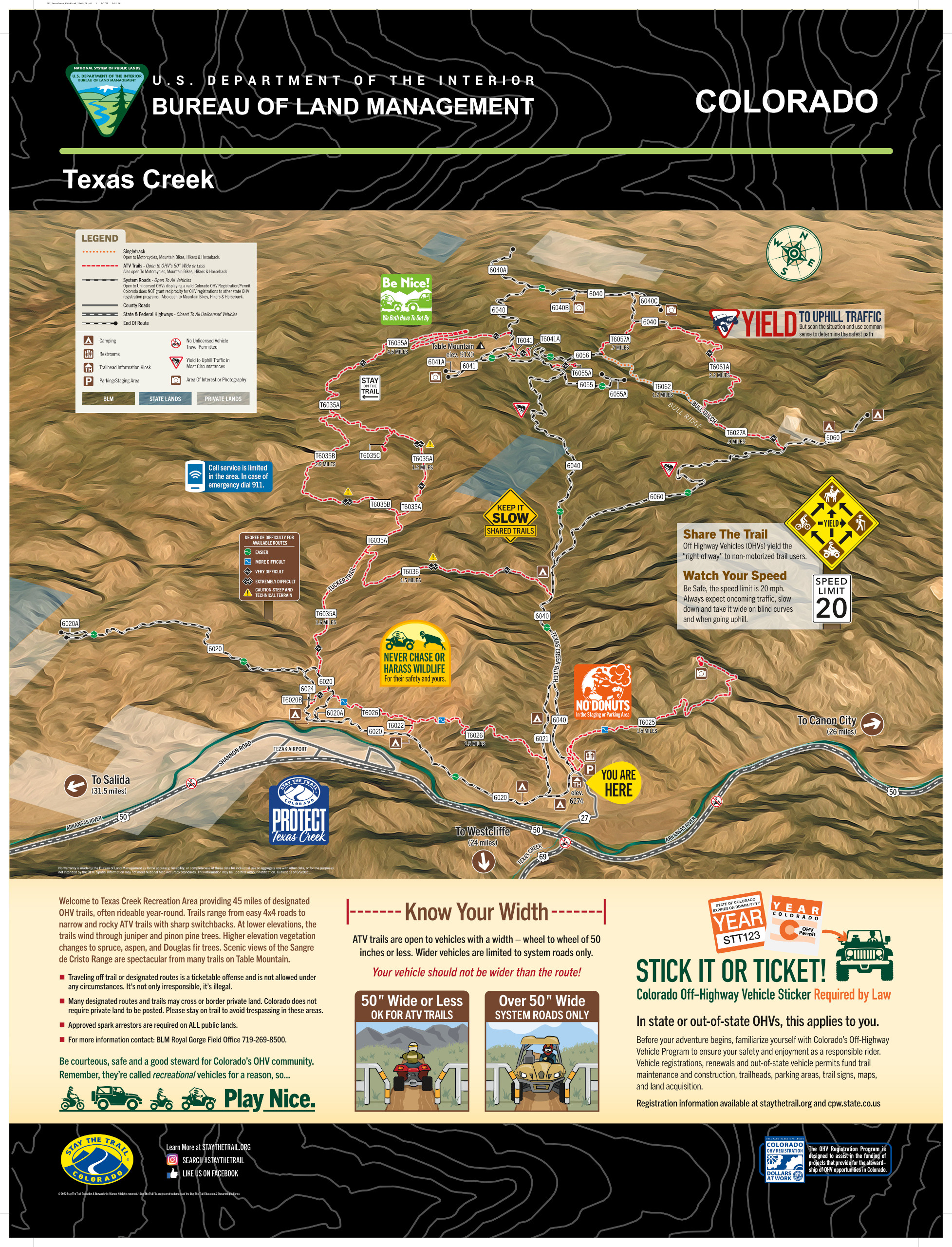
Texas Creek Trail Map (Texas Creek, Cotopaxi)
Turkey Rock Trials Area (Howard)
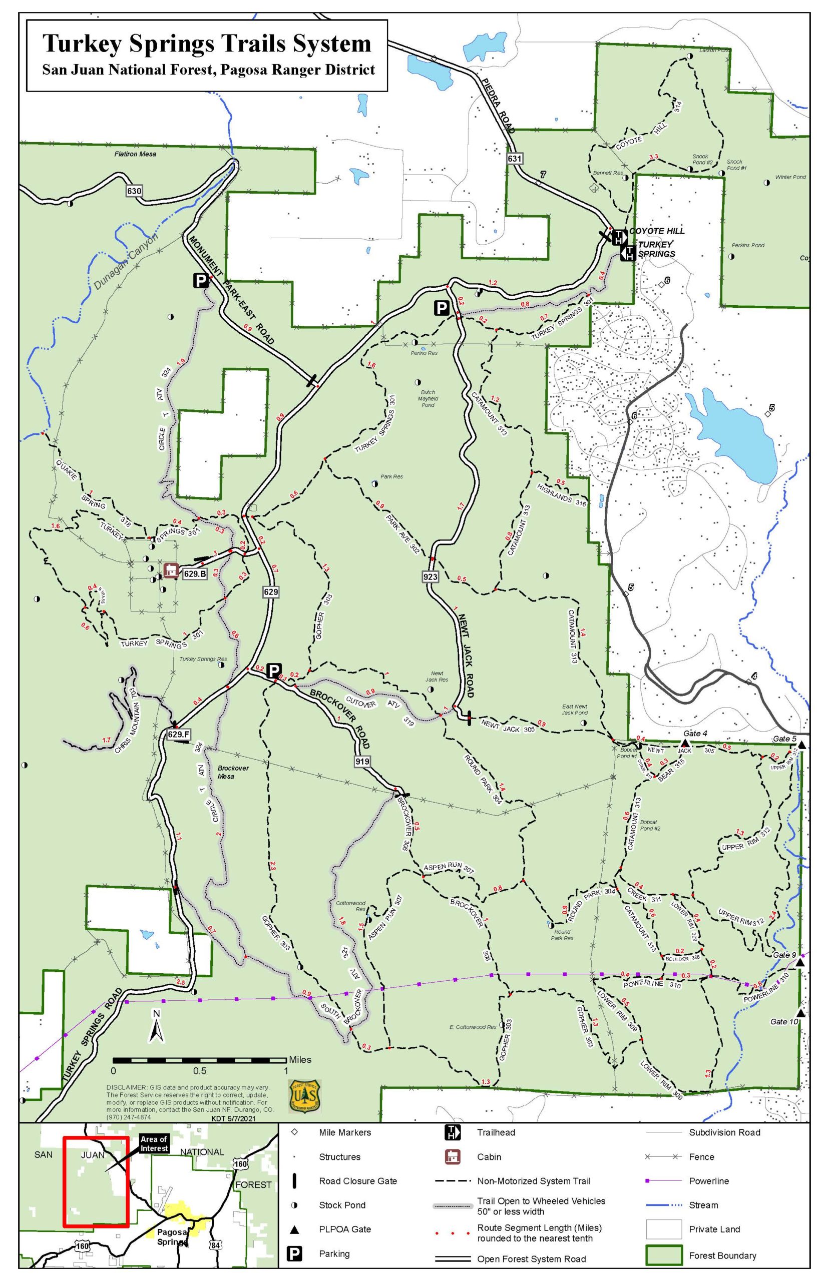
Turkey Springs Map (Pagosa Springs)
Wagon Wheel Trail System Map (Meeker)
Webster Pass North, Radical Hill, Deer Creek Road (Montezuma)
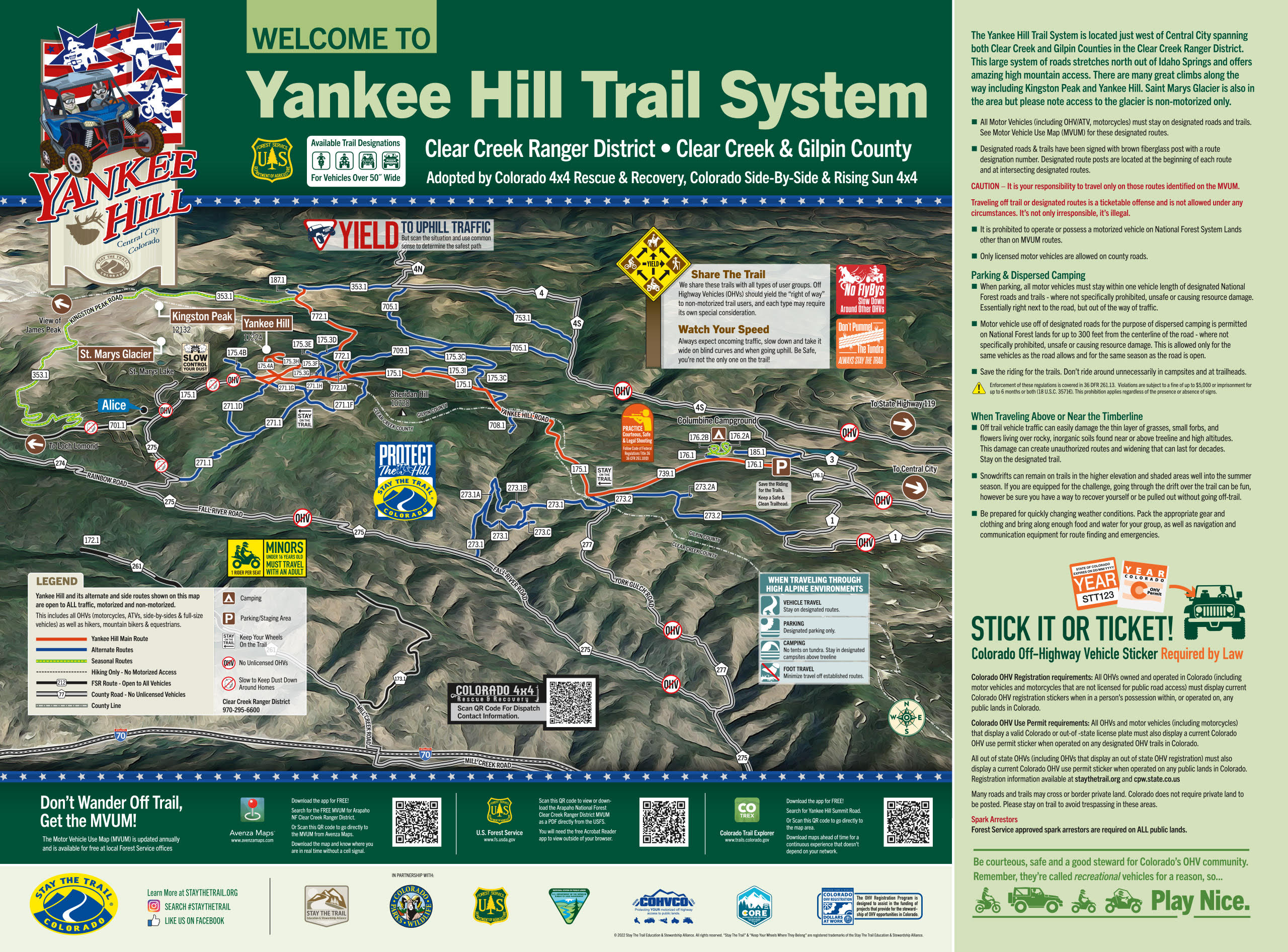
Yankee Hill (Central City, Black Hawk, St. Mary’s Glacier)